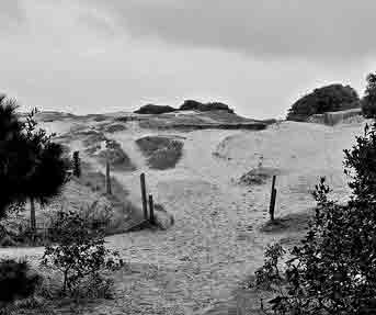
Quennevais, the largest Vingtaine in St Brelade is now one of the more populated areas of the island, well served by shopping precincts, a secondary school and sporting facilities. But these are very recent developments to an area of Jersey that was once described as an Arabian desert in the midst of an island of the highest fertility.
Sand dunes
This is evident on the 1795 Duke of Richmond map on which the Les Quennevais area is the largest parcel of uninhabited or uncultivated land on the whole island, predominantly marked by sand dunes.
Geological and archaeological reports link this topography to abnormally stormy conditions during the 13th and 14th centuries, which deposited vast quantities of sand on to the land as a result of severe westerly gales. As an alternative theory to this there is a well-documented legend, which records that the area was actually spoilt by divine punishment following the plundering by the locals of five Spanish ships, shipwrecked off the coast in about 1495.
Jean Huelin
On the 1849 Godfray map there are very few houses marked; notable exceptions being Jean Huelin’s house at the crossroads which have become known as Red Houses; Don Farm; houses at Franc Fief and Le Ville es Quennevais.
Jean Huelin’s house and farm once stood on the site where Mark’s and Spencer and the Co-op stand today. In 1864 the property was sold to Jean de Gruchy, farmer, who owned it for nearly 20 years. It is believed that the name Red Houses/Rouge Maisons arose from the red tiles on the stables at Oakleigh, which were situated on the opposite side of the road, where the public car park is now. By the 1891 census the property is inhabited by the Leatt family who kept the house and land in the family for a number of generations. Thomas James Leatt sold the property and land in 1963 to Queenleigh and McCormick, who demolished the house and built shops for lease to retailers.
Don Farm
Don Farm, as the name suggests, was an agricultural farm, built on crown land by General Don during his period of Governorship of the island between 1806 and 1814. He is more widely acclaimed for his improvement of the islands road system to strengthen the islands defences, however he was also concerned with possible food shortages on the island during wartime periods. He built Don Farm to demonstrate that land, which most people considered highly unsuitable for arable crops, could be successfully cultivated.
Sources record the farm flourishing until at least 1837, however in the 1861 census the farm is actually listed as Don Farm/Providence School and is being run by the Le Gros sisters and their brother. The crown sold Don Farm in 1892 to James Carrel and it was kept in the family for a number of generations, eventually passing into the Le Brocq family through marriage. Ironically it was sold back to the States for housing in 1965 and Don Farm Estate constructed soon after.
Opposite Don Farm a railway station was built, with a tunnel called Don Bridge, which ran directly underneath Quennevais Road. The Jersey Railway running between St Helier and St Aubin commenced in 1870 but it was not until 1885 that the service was extended further west to Corbiere, passing through Beaumont and Quennevais. Don Bridge station was extremely busy due to considerable military passenger traffic for the nearby St Peter’s Barracks and militia camps, as well as for recreational users attending the Quennevais horse racing. On the bank holiday weekend alone, on August 1921, 12,307 passengers were recorded using the train to travel to the racing. Sadly, like the Eastern Railway, business dwindled in the early 1930’s as a direct result of the competition from the bus service. However it was the disastrous fire at St Aubin’s train station on 18 October, which finally forced the railway to close following the destruction of 16 passenger carriages as well as the station and sheds. The area of land encompassing the track between St Aubin and Corbiere was subsequently bought by the states for use as a pedestrian walkway. Known locally as the Railway Walk, it is a fantastic legacy of the railway, well frequented by islanders and their families.
Militia
There has been a strong military presence at various times in this part of St Brelade.The Jersey Militia used the area adjacent to Don Farm for military training and held regular camps there, with up to 500 militia men camped in over 100 canvas tent. There was also permanent accommodation at the Red Houses crossroads on the site of the present car park.
Quennevais is well known for it’s sporting facilities particularly with the building of the multi purpose sports centre in 1996. But nearly 100 years ago thousands of people flocked to Le Quennevais for the sport of King’s – horse racing. The course was situated where the sports centre and grounds are now situated and the Jersey Race Club’s meetings of the summer months were very popular and well attended from 1900 through to the 1950s.
His Majesty’s Cup race was held there until 1936, where the cup presented to the winner was paid for from the privy purse of King George V. It was not only horseracing that took place at the Quennevais track: in 1904 greyhound racing was held there and in 1933 Jersey’s first air pageant was observed by approximately 10,000 from the racecourse. One of the stars of the pageant was the Honourable Mrs Victor Bruce, an Englishwoman, who was the first woman to fly around the world alone.


