


The coat of arms of the parish shows the Shield of the Trinity diagram.
The Parish church has a distinctive white pyramidal spire.
The Le Vesconte memorial (erected 1910) takes the form of an obelisk at a crossroads commemorating Philippe Le Vesconte (21 December 1837 - 21 August 1909) who was 10 times elected Constable between 1868-1877 and 1890-1909.
In folklore, the area of Bouley Bay has been reputed to be haunted by the Tchian d'Bouôlé (Black Dog of Bouley), a phantom dog whose appearance presages storms. The story is believed to have been encouraged by smugglers who wanted to discourage nocturnal movements by people who might witness the movement of contraband at the harbour in Bouley Bay.
Trinity Manor is the home of the Seigneur of Trinity. One of the feudal duties of the holder of this fief is to present the Monarch with a pair of mallards when he or she visits the Island.
History
- From the parish magazine Trinity Tattler
It is easy to forget, with today's stringent planning laws, that in the not too distant past, people could build a house anywhere they wanted to. Given that freedom, how were the first building plots chosen? Why build here and not there? Perhaps it was not quite so simple. When the fiefs were active the Seigneur would surely have had a say. Later the choice may well have had much to do with the availability of fresh water, shelter and the type of land most suited to the dominant agricultural trade of the time.
Access to such roads as there were would have been important for merchants and traders.The Duke of Richmond’s map was drawn in 1787 and published in 1795. A political ally of Pitt the Younger, the 3rd Duke was a progressive and reformist Master General of the Ordnance and was responsible for laying the foundationof what was to become the Ordnance Survey map of Great Britain. This map shows all dwellings in the island at the time and is an important indicator of the main areas of collective occupation at a time just before the threat emerged of a possible invasion by Bonaparte.
Orchards
One of the most striking things about this map is the large number of orchards which supported a thriving cider-making industry. For instance, Ville-a-l'Evecque's eleven dwellings, were almost totally surrounded by orchards. By showing every orchard across the island, Richmond was clearly making a statement about the economic importance of the industry. Another area with a significant number of dwellings, also surrounded by orchards, was just north of what is now Woodside Farm.
Away from the orchards it can be seen that that there were at least nine dwellings at the junction of what is now Vieille Charriere and Rue de l’Epine. They must surely have been somehow associated with fishing and the important trading routes between Bouley Bay and the Cotentin Peninsula. Historian Joan Stevens recorded the existence of a property called La Binaud, now demolished, with 16th century features at the bottom of Rue de l’Epine. Richmond shows the road from the bottom of Vieille Charriere, across the hillside past the lavoir and connecting with Vieilles Charrieres on the other side and up to where The Mount now stands.
The lavoir is inscribed with the initials of those who were permitted to use it. There is no road recorded from here to the bay, so it must have been no more than a footpath at best, probably an extension of the perquage from the parish church. There are quite a few dwellings also in the other direction along l’Epine towards Rue des Fontaines, which suggests that this was a main road leading to the parish church from the bay at that time. The abundance of freshwater springs in the area allowed the steep, narrow lane to have at least two drinking troughs for horses.
Four dwellings are shown at Egypt, but there is no indication on this map, or any later ones, of the existence of a dwelling on the track from Egypt to Petit Port. The remnants of this house are still visible. Given its isolated situation and obvious importance, judging by the corbelled fireplace remnants, the mystery surrounding this ancient house is intriguing. Moving inland, the next sizeable collection of dwellings is around the church, but the road from the top of Bouley Bay Hill which follows the modern Route de Boulay, Rue du Carrefour and Rue du Travers, was, for its time, quite densely populated with many of the dwellings no longer in existence.
Important thoroughfare
It is tempting to conclude that this was an important thoroughfare between Bouley Bay and St Helier before General Don built his more direct military roads. The construction of the new road from St Helier to Trinity Church and beyond in the Napoleonic era would have made this old route much less travelled and properties that might have been old and insubstantial would probably have been abandoned in favour of new sites on busier highways. There was another cluster of dwellings along the section of the St Helier road between Rue Jacques and Les Ifs, which retained their importance when the new road went directly past them. [1]
The Hugh Godfrey map drawn 60 years later shows all dwellings in the island and the names of their owners. By this time, thanks no doubt to the General, the road went all the way down to Bouley Bay. A five-mile stone is indicated just above the harbour and the harbour wall is shown. The new road to Rozel had also been completed. The houses along Rue du Travers were still shown on this 1859 map, but there was still no sign of the school. Approaching the church was Vue du Temple on the corner opposite Maison Maret. This is believed to have been a shop, where there now stands a fine horse chestnut tree and below this is a property called the Drill Hall, which became The British pub before disappearing.
Ville ès Normans is shown, but with the road passing much closer to the houses than it does nowadays. No fewer than four of the six dwellings shown here were owned by P Norman and a fifth by I Norman. The parish boundary with St John at Hautes Croix seems to be ananomaly given that the rest of the border runs along Rue du Bechets ès Cats and Grande Route de St Jean. The story has it that this area was ceded to Trinity by St John in lieu of an unpaid debt. Revenues from the rates presumably being the crux of the deal.
The number of properties had increased over the years but there was still no particular density of occupation which could be thought of as the heart of the parish. This was to change when Victoria Village was built, but it was village in name only, lacking any of the amenities normally associated with a village. Ironically the two small shops which predated the development are now both gone. Much more in the village tradition is the area around the church which now includes Le Grand Clos, for first-time buyers, and Les Maisons Cabot for more senior parishioners, as well as a thriving pub and village shop, one of the last remaining convenience stores in the parish. Within living memory there were four small shops on Route de Trinité and one at Le Vesconte Monument, as well as this one.
Subdivisions
Trinity is divided into the following vingtaines:
- Vingtaine de la Ville-à-l'Évêque
- Vingtaine de Rozel
- Vingtaine du Rondin
- Vingtaine des Augrès
- Vingtaine de la Croiserie
- 1532 Trinity trésor roll, a list of 16th Century residents of the parish
- A history of Trinity
- Trinity fiefs Added 2023
- Trinity war memorial
- Trinity residents' Occupation memories
Twin town
Trinity is twinned with Agon-Coutainville in Normandy
Links
- Victoria Village Added 2018
- Trinity Official Parish website
Jardin d'Olivet follies


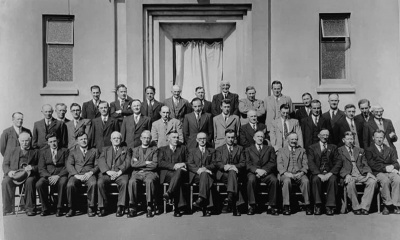

Unfortunately we have no dates for these three group photographs of parish officers


Bicycle licence

Victoria Village

Victoria Village

The parish hall

The parish Clos des Pauvres

Lane leading to Trinity Church

AA box opposite the church

Traditional signs

A sign at an entrance to Commune de La Gruchetterie, commonly known as Jardin d'Olivet

1889 Nouvelle Chronique advert for parish event. But where was the Hotel Newbegin?

Les Platons telecoms and television masts


Coach home
For some 30 years Adele Melanie Martret lived on the heights of Les Platons in a wheel-less Tantivy bus. She became so famous that she warranted the attention of even the Lieut-Governor, who made a special visit to see her in her unconventional home.
This fiercely independent woman had lived for some time with her father in a small dwelling on the north coast, but after his death in the 1950s, Rediffusion purchased the land the house was built on and demolished it. Adele was forced to find somewhere new to live.
It came as a total surprise to locals when, soon afterwards a bus appeared in the old quarry with Adèle in residence. Perched on breeze blocks and looking from a distance for all the world like a round-Island tour parked up for a scenic stop the bus in its distinctive Tantivy colours became a familiar sight to all passers-by on the coast road. Adele by now lived alone except for her dogs. Ruth Picot whose husband Len, one time Connetable of Trinity, remembers there were seven at one point and drew the attention of her own house dog, a bulldog, which had frequent altercations with those in the bus. Len visited her often and kept a close eye on her welfare throughout always making sure he visited on Christmas morning when he and Adèle would toast each other over a festive tipple.
Eventually Adele had a telephone which she used extensively, enabling her to keep in close contact with her friends.
Very little of what happened in the Parish escaped her attention and she could be relied upon to give the up-to-date account of any ongoing situation. She could be seen often going down to the shop with her bike, at first riding it but later when she could no longer do so, pushing it with her bags hanging from the handlebars.
The bus could have afforded very few home comforts, especially in the depths of winter but there were lights powered by car batteries and, eventually, even a television. For Adele life would no doubt have been a little easier in the summer months, when she loved to sit outside in the sunshine and fresh air with pot-grown vegetables and flowers decorating the area around.


Notes and references
- ↑ It is mere supposition that buildings were abandoned because traffic routes changed. Throughout the island there are long-standing buildings linked to farming which are well off the beaten track